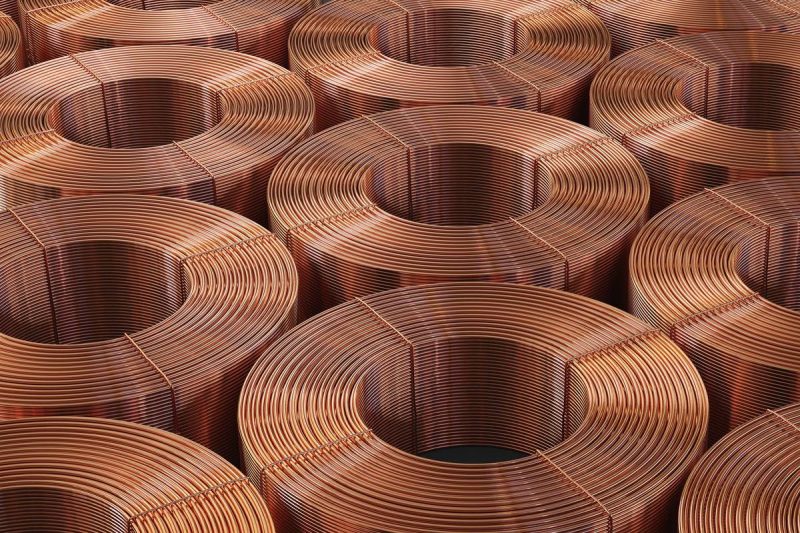
Category

Investing

Category

Harmony Gold Mining (NYSE:HMY,JSE:HAR) announced that it has approved development of its Eva Copper project in Queensland after completing an updated feasibility study, with an estimated capital of US$1.75 billion across a three-year window.

The South African miner said Monday (November24) that its board signed off on the Final Investment Decision for the Eva copper project, a 100-percent-owned project in northwest Queensland expected to deliver high margins and a long operating life.

Harmony plans to build a low strip-ratio open-pit mine capable of producing about 65,000 metric tons of copper concentrate annually during its first five years, with an average life-of-mine profile of roughly 60,000 metric tons of copper and 19,000 ounces of gold per year over an estimated 15-year span.

The mine will process about 18 million metric tons of ore per year and carry an all-in sustaining cost of approximately US$2.50 per pound.

CEO Beyers Nel said the feasibility results confirm the company’s shift toward a balanced gold-and-copper portfolio.

“The Eva Copper Feasibility Study delivers a strong, high-confidence outcome that positions Harmony for the next phase of growth as we continue building a high-quality, low-cost portfolio,” he said.

Nel also tied Eva Copper to Harmony’s expanding strategy, pointing to the company’s recently completed MAC Copper acquisition.

“Eva Copper, together with our recent MAC Copper acquisition, creates a compelling platform that brings together the enduring value of gold with the future-facing strength of copper, enhancing cash flow resilience across commodity cycles,” he said.

Last month, Harmony completed its US$1.01 billion acquisition of MAC Copper, giving the company full ownership of the high-grade CSA copper mine in New South Wales.

The company said the purchase builds on its strategic push to strengthen its copper position in Tier-1 jurisdictions. It also expects its two major Australian copper assets to deliver a combined 100,000 metric tons of copper annually once fully commissioned.

Meanwhile, the Eva Copper project was acquired by the company in October 2022 and has since completed 166,000 metres of drilling. The current two-million-metric-ton copper resource underpins the potential for future extensions to the mine’s life.

Harmony anticipates first production in the second half of 2028, a timeline it says aligns with a structural deficit in copper supply that could support stronger prices.

Board approval moves the project into the execution phase. Mobilization to site is expected in the third quarter of fiscal 2026, subject to amendments to the project’s Environmental Authority.

Securities Disclosure: I, Giann Liguid, hold no direct investment interest in any company mentioned in this article.

This post appeared first on investingnews.com

Canada One Mining Corp. (TSXV: CONE) (OTC Pink: COMCF) (FSE: AU31) (‘Canada One’ or the ‘Company’) is pleased to provide an exploration update following the Phase 2 exploration program conducted at its 100% owned Copper Dome Project, (‘Copper Dome’, ‘Project’ or ‘Property’), Princeton B.C.

2025 FIELD PROGRAM HIGHLIGHTS

  • Crews established 53 field stations with full metadata across the property, systematically documenting geological observations to contextualize mineral showings in relation to property-scale and regional geology.
  • A total of 29 rock samples were collected during the first phase of exploration and have been delivered to the laboratory for analysis.
  • Copper sulphides, including bornite and chalcopyrite, were observed in several rock samples. Assay results are pending.
  • Key alteration assemblages observed are indicative of proximity to porphyry centers.

Peter Berdusco, President and CEO of the Company commented: ‘We are thrilled with the Phase 2 exploration work, which identified numerous samples containing visible copper sulphide minerals. The Friday Creek zone emerged as a standout area of interest, and additional work is planned to further evaluate its mineralization footprint and potential within the broader Copper Dome system. Observing bornite in hand sample is a strong indicator of potential porphyry systems, and the project’s proximity to the Copper Mountain Mine only strengthens the geological narrative. The visible copper mineralization and potassic alteration signatures observed in these samples provide Canada One with a solid foundation to advance exploration and refine its 2026 objectives at the Copper Dome project.’

Exploration Summary

Crews completed the Phase 2 field program at the Copper Dome Project, with a primary focus on visiting historic MINFILE occurrences and applying modern exploration insight to reassess legacy data and descriptions. All documented MINFILE locations were successfully visited, and 53 field stations were collected with full metadata at each site. A total of 29 rock samples were submitted for analysis at ALS Geochemistry – Kamloops, and the Company expects an approximate four-week turn around on results. Historic workings and related infrastructure were mapped, documented, and georeferenced, with access conditions recorded for each location (See Figure 1).

The Company is encouraged by early field observations, which include chalcopyrite stringers, mineralized breccia cement, and bornite clots and stringers (see Figures 2-4).

Cannot view this image? Visit: https://images.newsfilecorp.com/files/10074/275866_34fbc694940758d3_002.jpg

Figure 1: Overview map of the Copper Dome project sowing sample and data stations as well as project infrastructure.

To view an enhanced version of this graphic, please visit:
https://images.newsfilecorp.com/files/10074/275866_34fbc694940758d3_002full.jpg

The Friday Creek Zone, located on the western portion of the claim block, hosts strong potassic alteration and visible chalcopyrite and bornite mineralization, commonly occurring with little to no pyrite. Alteration across the zone is similarly encouraging, with moderate to strong K-feldspar and biotite alteration commonly observed near the copper sulphides. This alteration and mineralization assemblage is a recognized indicator of prospective porphyry copper systems, suggesting that the outcrop may lie within the system’s central potassic zone.

The discovery of in-situ bornite at the Friday Creek zone is extremely encouraging. Bornite is a copper-bearing sulphide mineral (chemical formula Cu₅FeS₄, containing ~63% copper by mass), and its presence is commonly associated with proximity to porphyry centers. Bornite was observed across an approximate 150 m by 150 m area, highlighting a meaningful footprint of a high-temperature potassic zone and demonstrating strong potential for a porphyry system near surface. At Friday Creek, alteration was mapped over a vertical extent of roughly 100 meters, extending downslope to the valley bottom, where the strongest alteration intensity was recorded.

Cannot view this image? Visit: https://images.newsfilecorp.com/files/10074/275866_canadaone_figure2_550.jpg

Figure 2: Rock sample (2025JG0197), collected from the Friday Creek Zone, comprises a diorite intrusion exhibiting K-feldspar-biotite alteration and internal brecciation, hosting semi-massive bornite mineralization with associated stringers.

To view an enhanced version of this graphic, please visit:
https://images.newsfilecorp.com/files/10074/275866_canadaone_figure2.png

Bornite at the Friday Creek Zone occurs in several styles. A diorite unit was observed with moderate intensity K-feldspar alteration surrounding bornite stringers exhibiting an internally brecciated texture. The K-feldspar may represent an alteration envelope around the chaotic bornite vein swarm (See Figure 2).

Cannot view this image? Visit: https://images.newsfilecorp.com/files/10074/275866_34fbc694940758d3_005.jpg

Figure 3: Rock sample (2025JG0001), collected from the Friday Creek Zone, shows a brecciated pegmatite with hydrothermal breccia infill composed of quartz-biotite-sulphide cement.

To view an enhanced version of this graphic, please visit:
https://images.newsfilecorp.com/files/10074/275866_34fbc694940758d3_005full.jpg

Cannot view this image? Visit: https://images.newsfilecorp.com/files/10074/275866_canadaone_figure4_550.jpg

Figure 4: Rock sample (2025PK0003) from the Friday Creek Zone showing moderate k-feldspar and biotite alteration with blebby bornite and chalcopyrite mineralization.

To view an enhanced version of this graphic, please visit:
https://images.newsfilecorp.com/files/10074/275866_canadaone_figure4.png

The company intends to undertake a comprehensive interpretation of the initial field observations, integrating lithological, alteration, and mineralization data to refine the current geological setting.

A follow-up field program is scheduled to commence in Q2 2026, with objectives focused on delineating alteration zonation patterns, sulphide mineral distribution, and the structural controls on mineralization. Detailed petrographic and geochemical analyses will be employed to better constrain the relationship between the observed hydrothermal alteration assemblages and the inferred porphyry center at the Copper Dome Project. These efforts are expected to enhance the company’s understanding of the system’s geometry and vectoring potential, thereby guiding future drilling and exploration targeting.

All rock samples collected from the fall 2025 fieldwork program are pending and were submitted to ALS Geochemistry – Kamloops to be analysed for gold and platinum group elements (50 g fire assay), and multi-element geochemistry, including elements Cu, Pb, Zn, Co, and Ag (method ME-MS61).

About The Copper Dome Project

Copper Dome is located in the lower Quesnel Trough porphyry belt, one of British Columbia’s most prolific mining districts. The Project directly adjoins Hudbay Minerals Inc.’s (TSX: HBM) producing Copper Mountain Mine to the north, which the company reports as having Proven and Probable Reserves of ~367 Mt at 0.25 % Cu, 0.12 g/t Au, and 0.69 g/t Ag (Hudbay Minerals Inc., 2023). Multiple mineralized zones have been identified across the Property, with historical drilling confirming high-grade copper associated with northeast-trending structures similar to those hosting mineralization at Copper Mountain.

The technical and scientific information regarding the adjacent Copper Mountain Mine is sourced from Hudbay Minerals Inc.’s published reports. Mineralization at Copper Mountain should not be considered indicative of the mineralization on the Copper Dome Project.

Reference:
Hudbay Minerals Inc. (2023). NI 43-101 Technical Report – Updated Mineral Resources & Mineral Reserves Estimate, Copper Mountain Mine, Princeton, British Columbia. Effective date: December 1, 2023. Qualified Person: Olivier Tavchandjian, Ph.D., P.Geo. Available on Sedar+.

The Copper Dome Project benefits from excellent infrastructure, enabling year-round access, cost-efficient exploration, and a stable, low-risk jurisdiction.

Historical Work Completed

  • Geophysics: 51 km of induced polarization (IP); airborne magnetic and electromagnetic (EM) coverage over ~50% of the Property
  • Sampling: 2,253 soils and 378 rocks collected
  • Drilling: 8,900+ m of diamond drilling
  • Trenching: Over 1 km excavated

With a five-year drill permit in place, the Company is focused on advancing the Project toward drill-ready target definition.

About Canada One

Canada One Mining Corp. is a Canadian junior exploration company focused on copper-the critical metal powering the global energy transition. The Company advances projects from discovery through resource definition with disciplined, data-driven exploration and responsible practices. Its flagship Copper Dome Project, near Princeton, British Columbia, targets a porphyry copper-gold system in a Tier-1 jurisdiction. Canada One aims to deliver sustainable growth and long-term value for shareholders and local communities.

Acknowledgement

Canada One acknowledges that the Copper Dome Project is located within the traditional, ancestral and unceded territory of the Smelqmix People. We recognize and respect their cultural heritage and relationship to the land, honoring their past, present and future.

Qualified Person

The technical information contained in this news release has been reviewed and approved by Ali Wasiliew, P.Geo., a ‘qualified person’ as defined in NI 43-101 – Standards of Disclosure for Mineral Projects.

Historical Sampling

The sampling was done to the standards of the time and is considered ‘historical’ in nature and is not NI43-101 compliant and cannot be relied upon. The results are listed here to show why the Company is interested in this area. Future work and drilling may not repeat similar results.

Contact Us

For further information, interested parties are encouraged to visit the Company’s website at www.canadaonemining.com, or contact the Company by email at info@canadaonemining.com, or by phone at 1.877.844.4661.

On behalf of the Board of Directors of
Canada One Mining Corp.

Peter Berdusco
President
Chief Executive Officer
Interim Chief Financial Officer

Forward-Looking Statements

This press release includes certain ‘forward-looking information’ and ‘forward-looking statements’ (collectively ‘forward-looking statements’) within the meaning of applicable Canadian securities legislation. All statements, other than statements of historical fact, included herein, without limitation, statements relating to the future operating or financial performance of the Company, are forward looking statements. Forward-looking statements are frequently, but not always, identified by words such as ‘expects’, ‘anticipates’, ‘believes’, ‘intends’, ‘estimates’, ‘potential’, ‘possible’, and similar expressions, or statements that events, conditions, or results ‘will’, ‘may’, ‘could’, or ‘should’ occur or be achieved. Forward-looking statements in this press release relate to, among other things: statements relating to the anticipated timing thereof and the intended use of proceeds. Actual future results may differ materially. There can be no assurance that such statements will prove to be accurate, and actual results and future events could differ materially from those anticipated in such statements. Forward looking statements reflect the beliefs, opinions and projections on the date the statements are made and are based upon a number of assumptions and estimates that, while considered reasonable by the respective parties, are inherently subject to significant business, technical, economic, and competitive uncertainties and contingencies. Many factors, both known and unknown, could cause actual results, performance or achievements to be materially different from the results, performance or achievements that are or may be expressed or implied by such forward-looking statements and the parties have made assumptions and estimates based on or related to many of these factors. Such factors include, without limitation: the timing, completion and delivery of the referenced assessments and analysis. Readers should not place undue reliance on the forward-looking statements and information contained in this news release concerning these times. Except as required by law, the Company does not assume any obligation to update the forward-looking statements of beliefs, opinions, projections, or other factors, should they change, except as required by law.

TSX Venture Exchange Disclaimer

Neither the TSX Venture Exchange nor its Regulation Services Provider (as that term is defined in the policies of the TSX Venture Exchange) accepts responsibility for the adequacy or accuracy of this release.

Corporate Logo

To view the source version of this press release, please visit https://www.newsfilecorp.com/release/275866

News Provided by Newsfile via QuoteMedia

This post appeared first on investingnews.com

Rio Silver Inc. (TSX-V: RYO | OTC: RYOOF ) (‘ Rio Silver ‘ or the ‘ Company ‘) is pleased to provide a corporate update outlining ongoing operational preparations and strategic initiatives as the Company advances toward becoming a high-grade silver producer in Peru, the world’s second-largest silver-producing nation.

Over recent weeks, Company President Chris Verrico, in-country Peruvian Project Manager and Geologist Miller Fernandez, Logistics Manager José Peña and Principal Geological Consultant Edgar Leon, completed a detailed site visit to the Maria Norte Au-Ag-Pb-Zn Project. The team confirmed the scope, sequencing, and logistical requirements to fast-track development work immediately upon regulatory approval of the pending acquisition.

Operational Highlights

  • Development Program Ready to Launch: Field team completed a full development review at Maria Norte, confirming immediate sequencing and readiness to begin work upon Exchange approval of the acquisition.
  • Infrastructure and Portal Access Advancing: Preparations underway for high-altitude camp construction, laydown areas, portal-access upgrades, and drift/tunnel advancement along known mineralized structures.
  • Permitting and Community Agreements Progressing: Explosives permitting and final stakeholder access agreements are advancing positively within one of Peru’s most established silver-producing regions.
  • Leveraging Peru’s Proven Development Model: The Company is adopting Peru’s exploration/exploitation framework, enabling mineral generation while concurrently establishing underground drill platforms for resource definition.
  • Evaluating Additional District-Scale Opportunities: Management has identified several silver-dominant targets within trucking distance that may offer accretive district-scale growth potential.

‘Rio Silver is laying the foundation for what we believe can become one of Peru’s next high-grade silver operations,’ said Chris Verrico, President and CEO. ‘Our recent technical review confirmed the strength of the mineralized structures at Maria Norte and validated our plan to advance a rapid, efficient development model. With strong local support, a skilled in-country team, and a well-funded treasury, we are moving with purpose toward unlocking the full potential of this emerging silver district. We see a tremendous opportunity ahead—not only at Maria Norte, but across the broader belt where we continue to evaluate additional high-grade prospects.’

Royalties and Additional Strategic Interests

Rio Silver also benefits from a suite of long-term royalty and equity interests that strengthen the Company’s financial position and provide meaningful, non-dilutive value as it advances its core Peruvian portfolio.

The Company currently receives approximately US$150,000 per year in advanced royalty payments, forming a stable baseline of recurring revenue. In addition, the sale of the Niñobamba project to Magma Silver Corp. provides Rio Silver with milestone payments exceeding US$2 million , along with 2,500,000 common shares of Magma Silver and a further 2,500,000 shares on the first anniversary of approval ( see news release here ). Magma Silver Corp. last traded at $0.20 per share as of market close on November 24, 2025, underscoring the tangible value of this equity exposure. Rio Silver also retains a 2% NSR royalty on Niñobamba, complementing the 3% capped NSR royalty held from the Company’s former Palta Dorada interests.

Beyond its Peruvian assets, Rio Silver maintains ownership of a highly prospective critical-metals project in Ontario’s Ring of Fire, one of Canada’s most important emerging mineral districts. A 2012 airborne EM survey conducted by Fugro identified one of the strongest electromagnetic anomalies ever recorded by the firm—an indicator of significant subsurface potential. Historical drilling by INCO in the 1970s intersected encouraging geology but was never advanced due to non-technical circumstances of the era. Today, Rio Silver continues to engage positively with local First Nations communities as it evaluates the long-term potential of this strategically located asset.

Why This Matters to Investors

Peru remains one of the world’s most important silver jurisdictions, hosting multiple long-life underground mines and well-established infrastructure. Rio Silver is advancing a strategy centered on:

  • High-grade, high-margin silver mineralization in a district with proven production potential.
  • A rapid development model that allows for resource delineation and mineral generation concurrently—an approach widely used in Peru.
  • Proximity to established processing facilities , reducing potential future capital requirements.
  • A district-scale vision , with additional prospective acquisitions under evaluation.
  • A tight, aligned shareholder base and a strengthened treasury to support near-term catalysts.

As global silver demand accelerates—driven by industrial electrification, AI-related infrastructure, renewable energy, and precious-metal investment—Rio Silver is positioning itself as a pure-play developer with meaningful leverage to rising silver markets.

Engagement With Leading Communications Firm Caram Media
Partnering with Caram Media strengthens Rio Silver’s commitment to disciplined growth, clear market communication, and strong alignment with shareholders as the Company advances its near-term development strategy in one of the world’s most historically productive silver belts.

Galen Carson, President of Caram Media, commented: ‘We’re excited to partner with Rio Silver as they advance one of the most compelling emerging silver stories in Peru. Our team looks forward to helping bring this remarkable opportunity to the broader market with clarity, precision, and the strategic focus it deserves. It’s an inspiring project with tremendous energy behind it, and we’re thrilled to support the next phase of Rio Silver’s journey.’

Compensation and Terms
Under the consulting agreement dated November 14, 2025, Rio Silver has retained Caram Media Inc. for an initial six-month term. Caram Media will receive CAD $100,000 plus applicable GST as the first and last months’ fees paid in advance, followed by monthly payments of CAD $50,000 plus GST thereafter. Additional discretionary compensation may be considered by Rio Silver at its sole discretion and in accordance with applicable securities regulations. Either party may terminate the agreement with thirty (30) days’ written notice.

Qualified Person Statement

The scientific and technical information contained in this release has been reviewed and approved by Jeffrey Reeder, P.Geo., a Qualified Person as defined under National Instrument 43-101 – Standards of Disclosure for Mineral Projects.

About Rio Silver Inc.

Rio Silver Inc. (TSX-V: RYO | OTC: RYOOF) is a Canadian resource company advancing high-grade, silver-dominant assets in Peru, the world’s second-largest silver producer. The Company is focused on near-term development opportunities within proven mineral belts and is supported by a seasoned technical and operational team with deep experience in Peruvian geology, underground mining, and district-scale exploration. With a clear development strategy, and a growing portfolio of highly prospective silver assets, Rio Silver is establishing the foundation to become one of Peru’s next emerging silver producers.
Learn more at www.riosilverinc.com

ON BEHALF OF THE BOARD OF DIRECTORS OF Rio Silver INC.

Chris Verrico
Director, President and Chief Executive Officer
Neither the TSX Venture Exchange nor its Regulation Services Provider accepts responsibility for the adequacy or accuracy of this release.

For further information,
Christopher Verrico, President, CEO
Tel: (604) 762-4448
Email: chris.verrico@riosilverinc.com
Website: www.riosilverinc.com

Cautionary Note Regarding Forward-Looking Information

This news release contains ‘forward-looking statements’ within the meaning of applicable Canadian securities laws. All statements in this release that are not historical facts are forward-looking statements and are based on expectations and assumptions as of the date of this release. Forward-looking statements relate to future events or performance and include, but are not limited to, statements regarding the Company’s planned exploration and development activities at the Maria Norte Project, expected timelines for regulatory approvals, future work programs, engagement with local stakeholders, geological interpretations, and the Company’s ability to advance its assets toward potential development.

Forward-looking statements involve known and unknown risks, uncertainties, and other factors that may cause actual results to differ materially from those expressed or implied. These risks include, but are not limited to, operational risks, regulatory risks, geological uncertainties, availability of financing, community and social risks, commodity-price fluctuations, and general economic conditions. Additional risks are described in the Company’s filings available on SEDAR+ at www.sedarplus.ca .

Readers are cautioned not to place undue reliance on forward-looking statements. Rio Silver does not undertake to update forward-looking statements except as required by applicable law.

Neither the TSX Venture Exchange nor its Regulation Services Provider accepts responsibility for the adequacy or accuracy of this release.

Primary Logo

News Provided by GlobeNewswire via QuoteMedia

This post appeared first on investingnews.com

Saga Metals Corp. (‘SAGA’ or the ‘Company’) (TSXV: SAGA,OTC:SAGMF) (OTCQB: SAGMF) (FSE: 20H) a North American exploration company advancing critical mineral discoveries, is pleased to announce the completion of its first 3 holes (R-0008 to R-0010) of the 2025-2026 mineral resource estimate drill program focusing on the high-priority Trapper Zone at its 100%-owned Radar Titanium-Vanadium-Iron (‘Ti-V-Fe’) Project located near Cartwright, Labrador.

Highlights (see Cross-section N-11 in Figure 1 below)

  • R-0008 delivered an impressive 156 m of continuous gabbronorite with semi-massive to massive oxide,
  • R-0009 confirmed the same unit as well as extended it by another 165 m with increasing oxide content.
  • Additionally, substantially all the remaining intersections were within layered gabbronorite with intercumulus oxide mineralization. Intercumulus oxides crystallize from late, residual melt that becomes trapped in the pore spaces between the cumulus silicate minerals during formation of the gabbronorite layers.

A Total Magnetic Intensity (TMI) anomaly from the 2025 ground survey delineated an apparent fold structure in the Trapper North Zone. Two diamond drill holes along drill section N-11 were placed to test the crest of the fold trace. Substantially all of the diamond drill holes R-0008 (272 m length) and R-0009 (299 m length) are in heavy oxide mineralization, with about half the length in semi-massive to massive oxides.

The 2025 Trapper Zone drilling employs down-hole tools to provide oriented diamond drill core, enabling the reconstruction of the true 3D orientation of geological structures. It is essential for structural geology, geotechnical assessment, and accurate geological modelling — especially in complex magmatic systems like layered mafic intrusions. Preliminary structural logging of R-0008 and R-0009 indicates an open, north-plunging antiform with limbs of moderate to steep-dipping gabbronorite layers.

Saga

Figure 1: Map of Cross-section N-11, containing drill holes R-0008 & R-0009, highlighting the intercepts of heavy oxide mineralization.

Drill Program Details

The complete cross section through the nose of the fold in Trapper North has shown impressive continuity as R-0008 (156 m of semi-massive to massive oxide) was extended by an additional 165 m following the same unit with drill hole R-0009.

  • R-0008 (Azimuth 38°, Dip -45°): The first drill hole (R-0008) concentrated on drilling through what is believed to be a large fold of the oxide layering in Trapper North. Drill holes are collard (Azimuth 38°, Dip -45°) to intercept the Northwest trending 77-to-85-degree dipping oxide layering at the best perpendicular angle. Placed along section to capture true width of oxide layering of the south limb, the hole will additionally yield data on the fold and structures associated with the northern Limb.
  • R-0009 (Azimuth 38°, Dip -45°) : The second drill hole (R-0009) concentrated on drilling through the remainder of the believed fold as started by R-0008. The drill hole was collard (Azimuth 38°, Dip -45°) to intercept the northern limb of the fold and to complete the cross-section started with R-0008.
  • R-0010 (Azimuth 0°, Dip -45°) : The third drill hole (R-0010) was drilled off the same drill pad as R-0009 to verify the best and most appropriate angle for drilling the northern limb of the fold. Additionally, this hole acted as a control for understanding the axial planar fault which runs W-E through the fold, as well as understanding the true width of northern limb and the contact of the layering.

Next Steps

Drill has continued with R-0011 already sitting at a depth of 200 m down hole. Drill hole R-0011 lies 100 m east along section of R-0009 & R-0010 and is already adding extensive strike to the semi-massive to massive oxide layering observed in the area.

Following the completion of R-0011, the drill will move to Trapper South where a full cross section is planned to follow the same 38-degree section alignment as R-0008 & R-0009. With the same concept of the first 4 holes in the North, drilling in the south will concentrate on a section across the magnetic anomalies comprising of ~4 drill holes to allow Saga’s geological team to best understand and plan for the remainder of the mineral resource estimate drill program that will continue in Q1 of 2026.

Saga

Figure 2: Gladiator Drilling set up at R-0011. Photo looking west across the Trapper North Hill side.

‘We couldn’t have scripted a better start to our maiden drill program at the Trapper Zone,’ commented Michael Garagan, CGO & Director of Saga Metals. Hole R-0008 delivered an impressive 156 m of continuous semi-massive to massive oxide, and when we stepped out to R-0009 we not only confirmed the same unit but extended it another 165 m with ever-increasing magnetite content. To now have three completed holes highlighting an exceptional continuity of the oxide layering is an outstanding validation of our geological model. The team is genuinely thrilled with these early results and eager to keep the drill turning as we step east along strike in R-0011 and then move south to replicate this success across the full 3+ km Trapper oxide trend.’

Drill Program Objectives:

The Phase 1 Trapper Zone drill campaign will target:

  • Grade continuity across a 3 km strike length.
  • Oxide layering widths and continuity to true depths of about 200 meters below surface.
  • Integration of structural insights from trenching and drilling into collar orientation and drill design.
  • Initial drilling of 1,500-2,500 m in 6-10 holes, each about 250 m in depth will be completed before the December break.
  • Test both the North and South sections of the Trapper zone prior to the seasonal break in order to fully define grades, widths and structures prior to initiating the detailed grid and drill sections in 2026, leading to a mineral resource estimate.
  • Drilling will be complemented by metallurgical sampling through the winter, with core from both the Hawkeye and Trapper zones undergoing detailed metallurgical testing.

Saga

Figure 3: Radar Project’s Trapper Zone depicting a 3+ km Total Magnetic Intensity (TMI) anomaly from the 2025 ground survey and the oxide layering trend. The Trapper Trail (in black) will be the target of the planned 15,000 m diamond drilling program aimed at establishing Saga’s maiden mineral resource estimation.

The Radar Property spans 24,175 hectares and hosts the entire Dykes River intrusive complex (about 160 km²), which is a unique position among Western explorers. Geological mapping, geophysics, and trenching have already confirmed oxide layering across more than 20 km of strike length, with mineralization open for expansion.

Vanadiferous titanomagnetite (‘VTM’) mineralization at Radar is comparable to global Fe–Ti–V systems such as Panzhihua (China), Bushveld (South Africa), and Tellnes (Norway), positioning the Project as a potential strategic future supplier of titanium, vanadium, and iron to North American markets.

Saga

Figure 4: Radar Project’s prospective oxide layering zone extends for an inferred 20 km strike length, as shown on a compilation of historical airborne geophysics as well as ground-based geophysics in the Hawkeye and Trapper zones completed by SAGA in the 2024/2025 field programs. SAGA has demonstrated the reliability of the regional airborne magnetic surveys after ground-truthing and drilling in the 2024 and 2025 field programs .

Qualified Person

Paul J. McGuigan, P. Geo., is an Independent Qualified Person as defined under National Instrument 43-101 and has reviewed and approved the technical information disclosed in this news release.

About Saga Metals Corp.

Saga Metals Corp. is a North American mining company focused on the exploration and discovery of a diversified suite of critical minerals that support the North American transition to supply security. The Radar Titanium Project comprises 24,175 hectares and entirely encloses the Dykes River intrusive complex, mapped at 160 km² on the surface near Cartwright, Labrador. Exploration to date, including a 2,200m drill program, has confirmed a large and mineralized layered mafic intrusion hosting vanadiferous titanomagnetite (VTM) with strong grades of titanium and vanadium. The Double Mer Uranium Project, also in Labrador, covers 25,600 hectares featuring uranium radiometrics that highlight an 18km east-west trend, with a confirmed 14km section producing samples as high as 0.428% U 3 O 8 and uranium uranophane was identified in several areas of highest radiometric response (2024 Double Mer Technical Report).

Additionally, SAGA owns the Legacy Lithium Property in Quebec’s Eeyou Istchee James Bay region. This project, developed in partnership with Rio Tinto, has been expanded through the acquisition of the Amirault Lithium Project. Together, these properties cover 65,849 hectares and share significant geological continuity with other major players in the area, including Rio Tinto, Winsome Resources, Azimut Exploration, and Loyal Metals.

With a portfolio that spans key commodities crucial for the clean energy future, SAGA is strategically positioned to play an essential role in critical mineral security.

On Behalf of the Board of Directors

Mike Stier, Chief Executive Officer

For more information, contact:

Rob Guzman, Investor Relations
Saga Metals Corp.
Tel: +1 (844) 724-2638
Email: rob@sagametals.com
www.sagametals.com

Neither the TSX Venture Exchange nor its Regulation Service Provider (as that term is defined in the policies of the TSX Venture Exchange) accepts responsibility for the adequacy or accuracy of this release

Cautionary Disclaimer

This news release contains forward-looking statements within the meaning of applicable securities laws that are not historical facts. Forward-looking statements are often identified by terms such as ‘will’, ‘may’, ‘should’, ‘anticipates’, ‘expects’, ‘believes’, and similar expressions or the negative of these words or other comparable terminology. All statements other than statements of historical fact, included in this release are forward-looking statements that involve risks and uncertainties. In particular, this news release contains forward-looking information pertaining to the Company’s Radar Project. There can be no assurance that such statements will prove to be accurate and actual results and future events could differ materially from those anticipated in such statements. Important factors that could cause actual results to differ materially from the Company’s expectations include, but are not limited to, changes in the state of equity and debt markets, fluctuations in commodity prices, delays in obtaining required regulatory or governmental approvals, environmental risks, limitations on insurance coverage, inherent risks and uncertainties involved in the mineral exploration and development industry, particularly given the early-stage nature of the Company’s assets, and the risks detailed in the Company’s continuous disclosure filings with securities regulations from time to time, available under its SEDAR+ profile at www.sedarplus.ca. The reader is cautioned that assumptions used in the preparation of any forward-looking information may prove to be incorrect. Events or circumstances may cause actual results to differ materially from those predicted, as a result of numerous known and unknown risks, uncertainties, and other factors, many of which are beyond the control of the Company. The reader is cautioned not to place undue reliance on any forward-looking information. Such information, although considered reasonable by management at the time of preparation, may prove to be incorrect and actual results may differ materially from those anticipated. Forward-looking statements contained in this news release are expressly qualified by this cautionary statement. The forward-looking statements contained in this news release are made as of the date of this news release and the Company will update or revise publicly any of the included forward-looking statements only as expressly required by applicable law.

Photos accompanying this announcement are available at:

https://www.globenewswire.com/NewsRoom/AttachmentNg/999e6d25-b68d-4a9e-98f7-4ebdc3bcf272
https://www.globenewswire.com/NewsRoom/AttachmentNg/fdc2ccca-531e-45c5-bd9d-74491519c63f
https://www.globenewswire.com/NewsRoom/AttachmentNg/5d72c25b-66ed-480b-bea5-c32518fed1db
https://www.globenewswire.com/NewsRoom/AttachmentNg/4a03aa99-efd0-4179-aa02-20905b72d7bc

Primary Logo

News Provided by GlobeNewswire via QuoteMedia

This post appeared first on investingnews.com

(TheNewswire)

Noble Mineral Exploration Inc.

Toronto, Ontario November 25, 2025 TheNewswire – Noble Mineral Exploration Inc. ( ‘Noble’ or the ‘Company’ ) (TSX-V:NOB, FRANKFURT: NB7, OTCQB:NLPXF) is pleased to announce the acquisition through map staking of a rare earth element (‘REE’) enriched system on its Chapiteau Property located 100 kilometers south of the Strange Lake and B-Zone deposits and 38 kilometers northeast of the Crater Lake Scandium-Rare Earth resource.  The Labrador property consists of 25 map staked units for a total of approximately 647 hectares (Figure 1 and 2).

Figure 1: Chapiteau property in relation to the Strange Lake and Crater Lake properties.  Background is the first vertical derivative of aeromagnetic survey data (Adapted from Reference 2)


Click Image To View Full Size

Figure 2: Geology and anomalous samples on the Chapiteau Property (Adapted from Reference 2)

The property covers ground explored by Midland Exploration Inc (Midland) in 2010/2011.  During this time, Midland, completed a 3,143-line-kilometer airborne magnetic and radiometric survey that identified several new exploration targets for REEs.  With the results of the airborne survey, the Midland team prospected and sampled the exposed portions of these magnetic and radiometric anomalies. Regionally, the results from selected samples from 81 rock outcrops and locally derived and mineralized boulders returned very high values of up to 8.34% rare earth element oxides (TREOs), including yttrium. The proportion of heavy rare earth element oxides (HREOs) ranged from 2.29% to 12.85% HREO for samples containing more than 0.5% TREO. Analysis of individual REEs yielded significant results up to 8.22% cerium oxide (Ce2O3), 3.38% lanthanum oxide (La2O3), 3.39% neodymium oxide (Nd2O3), 0.66% yttrium oxide (Y2O3), 0.96% praseodymium oxide (Pr2O3), 0.19% dysprosium oxide (Dy2O3), and 0.35% gadolinium oxide (Gd2O3).

Regionally, the best concentrations of mineralization are associated with iron oxides nested in pegmatite-aplite dikes and plurimetric iron oxide clusters disseminated in an intrusion interpreted as an alkaline granite. Grab samples from twenty-six new mineralized areas returned values ranging from 1.02% to 8.34% TREO. The alkaline granite hosting this mineralization manifests itself as an airborne magnetic anomaly 9 kilometers in diameter.

On the property recently staked by Noble, six grab samples greater than 0.5% TREO were located by Midland.  They ranged from 1.40 to 3.02% TREO with:

  • 0.29 to 0.79% lanthanum oxide (La2O3),

  • 0.60 to 1.48% cerium oxide (Ce2O3

  • 0.06 to 0.14% praseodymium oxide (Pr2O3)

  • 0.23 to 0.45% neodymium oxide (Nd2O3),

  • 0.02 to 0.10% yttrium oxide (Y2O3)

  • 0.006 to 0.02% dysprosium oxide (Dy2O3)

  • 0.02 to 0.03% gadolinium oxide (Gd2O3)

A series of channel samples and one diamond drill hole (Y3-11-04) were completed on the Chapiteau property in 2011. (see Fig 3, 4 and 5).


Click Image To View Full Size

Figure 3: CP North channel samples and location of diamond drill hole Y3-11-04 (Adapted from Reference 2)

Drill hole Y3-11-04 was aimed at the CP North Showing. The hole intersected a grey-pink coarse grained alkaline granite with 2-3% disseminated iron oxides and amphiboles. A total of 29 samples varying in length from 1 to 1.5 meter were collected. All collected samples returned anomalous TREO + Y2O352 values averaging 0.14% TREO + Y2O3 ranging from 0.11 to 0.19% TREO + Y2O3. The best assay results returned 0.13% TREO + Y2O3 over 7.5m from 25.0 to 32.5 meters, 0.14% TREO + Y2O3 over 12.0 m from 38.0 to 50.0 meters and 0.16% TREO + Y2O3 over 7.5 m from 64.0 to 71.5m.


Click Image To View Full Size

Figure 4: Hematite North Zone with channel samples (Adapted from Reference 2)


Click Image To View Full Size

Figure 5: Hematite South Zone with channel samples (Adapted from Reference 2)

Please note that grab samples and channel samples are select samples and not necessarily representative of the mineralization hosted on the property.

The Chapiteau Property is located about 38 km northeast of the Crater Lake Property where Scandium Canada has defined a rare earth and scandium resource. (See Chart 1)


Click Image To View Full Size

Chart 1: Defined Resource at the Crater Lake Project owned by Scandium Canada.  Source: NI 43-101 Technical Report and Updated Mineral Resource Estimate for the Crater Lake Project, Quebec, Canada: Marina Lund, P.Geo., M.Sc., Simon Boudreau, P.Eng., Marc R. Beauvais, P.Eng: 2025

Above information in Chart 1 disclosed about Scandium Canada ‘s Crater Lake Property is not necessarily indicative of the mineralization on the Chapiteau property.

Acquisition of the Chapiteau Property further demonstrates Noble’s commitment to exploring for critical minerals in Canada.

References

  1. 1) Assessment Report of the Ytterby 3 Property by M. Sasias: S. Bourassa, and R. Banville, January 20, 2012

  2. 2) Rare Earth Element Mineralization in the Mistastin Lake and Smallwood Reservoir areas: A. Kerr and M. A. Hamilton, Current Research (2014) Newfoundland and Labrador Department of Natural Resources Geological Survey, Report 14-1, pages 45-62

The technical content of this release has been reviewed and approved by Mike Kilbourne, P.Geo., an independent Qualified Person as defined by National Instrument 43-101 – Standards of Disclosure for Mineral Projects .

About Noble Mineral Exploration Inc.

Noble Mineral Exploration Inc. is a Canadian-based junior exploration company, which has holdings of securities in Canada Nickel Company Inc., Homeland Nickel Inc., East Timmins Nickel Inc. (20%), and its interest in the Holdsworth gold exploration property in the area of Wawa, Ontario.

Noble holds mineral and/or exploration rights in ~70,000ha in Northern Ontario and ~24,000ha elsewhere in Quebec upon which it plans to generate option/joint venture exploration programs.

Noble holds mineral rights and/or exploration rights in ~18,000 hectares in the Timmins-Cochrane areas of Northern Ontario known as Project 81, ~2,215 hectares in Thomas Twp/Timmins, as well as an additional 20% interest in ~38,700 hectares in the Timmins area and ~175 hectares of mining claims in Central Newfoundland. Project 81 hosts diversified drill-ready gold, nickel-cobalt and base metal exploration targets at various stages of exploration. Noble also holds ~4,600 hectares in the Nagagami Carbonatite Complex and its ~3,200 hectares in the Boulder Project both near Hearst, Ontario.  ~3,700 hectares in the Buckingham Graphite Property, ~10,152 hectares in the Havre St Pierre  Nickel, Copper, PGM property, and ~1,573 hectares in the Cere-Villebon Nickel, Copper, PGM property, ~569 hectare Uranium/Rare Earth property (Chateau), ~461 hectare Uranium/Molybdenum property (Taser North),  ~4,465 hectares REE Mehmet Property, and the ~3300 hectare Gull Lake REE Property all of which are in the Province of Quebec .

https://www.noblemineralexploration.com

Noble’s common shares trade on the TSX Venture Exchange under the symbol ‘NOB’.

Cautionary Statement

Neither TSX Venture Exchange nor its Regulation Services Provider (as that term is defined in the policies of the TSX Venture Exchange) accepts responsibility for the adequacy or accuracy of this release. No stock exchange, securities commission or other regulatory authority has approved or disapproved the information contained herein.

The foregoing information may contain forward-looking statements relating to the future performance of Noble Mineral Exploration Inc. Forward-looking statements, specifically those concerning future performance, are subject to certain risks and uncertainties, and actual results may differ materially from the Company’s plans and expectations. These plans, expectations, risks and uncertainties are detailed herein and from time to time in the filings made by the Company with the TSX Venture Exchange and securities regulators.  Noble Mineral Exploration Inc. does not assume any obligation to update or revise its forward-looking statements, whether as a result of new information, future events or otherwise.

Contacts: H. Vance White, President

Phone:        416-214-2250

Fax:        416-367-1954

Email: info@noblemineralexploration.com

Investor Relations : ir@noblemineralexploration.com

Copyright (c) 2025 TheNewswire – All rights reserved.

News Provided by TheNewsWire via QuoteMedia

This post appeared first on investingnews.com

Exploration Program Targets Near-Mine Ounce Growth

Fortune Bay Corp. (TSXV: FOR,OTC:FTBYF) (FWB: 5QN) (OTCQB: FTBYF) (‘Fortune Bay’ or the ‘Company’) is pleased to announce that exploration drilling has commenced on multiple high-priority exploration targets at its 100%-owned Goldfields Gold Project (‘Goldfields’ or the ‘Project’) in northern Saskatchewan.

The targets include opportunities for resource expansion at the Box and Athona deposits, and potential for the addition of new resources from underexplored historical occurrences at Frontier, Golden Pond, and Triangle ­— all within two kilometres of past-producing and expected future mine infrastructure (Figure 1).

An initial 17 exploration holes (3,250 metres) are planned with provision to expand the program in a results-driven manner. The exploration drilling will be carried out in conjunction with development-related drilling, supporting advancement of Goldfields to Pre-Feasibility Study, as described in the Company’s recent News Release.

Gareth Garlick, VP Technical Services for Fortune Bay, commented ‘We have initiated drilling within three weeks of closing our financing, demonstrating the pace at which we intend to advance the Project. Goldfields is already positioned as a robust development asset in Canada’s top mining jurisdiction, with work toward pre-feasibility and permitting in progress. Our exploration program is designed to unlock additional near-mine ounces that could further strengthen Goldfields’ exceptional economics and improve the overall development profile.’

Box Deposit – High-Grades Open at Depth

The Box deposit is wide open at depth. The Company’s 2021 drilling confirmed high-grades extending up to 240 m beyond the extents of the current open-pit constrained Mineral Resource Estimate (‘MRE’) (Figure 2), including:

  • 13.22 g/t Au over 8.0 m from 426.0 to 434.0 m (drill hole B21-340)
  • 8.74 g/t Au over 5.0 m from 575.0 to 580.0 m (drill hole B21-339)
  • 8.00 g/t Au over 12.0 m from 509.0 to 521.0 m (drill hole B21-336)
  • 8.00 g/t Au over 4.0 m from 375.0 to 379.0 m (drill hole B21-334)

Four initial drill holes (2,000 m) are planned to test and infill large gaps (up to 170 m) in the existing drill hole coverage outside of the MRE to test for extensions to high-grade zones with underground mining potential.

Gold mineralization occurs in sheeted and stockwork quartz–sulphide veins within the Box Mine Granite (‘BMG’), controlled by N-S and NW-SE trending structures. The Box Deposit currently hosts an open-pit constrained mineral resource including 734,300 oz Indicated (16.2 Mt @ 1.41 g/t), and 114,100 oz Inferred (3.4 Mt @ 1.04 g/t) (effective date September 11, 2025).

Athona Deposit – Near-Pit Resource Expansion Potential

Mineral resources at Athona are hosted entirely within the Athona Mine Granite (‘AMG’). The outcropping Athona West Mine Granite (‘AWMG’) is located immediately west of the AMG and displays gold mineralization similar in style to the AMG, but has not seen sufficient drilling to support estimation of mineral resources (Figure 3).

Two initial drill holes (270 m) are planned with the dual purpose of testing mineralization continuity in the AWMG and testing an underlying extension of the AMG below the AWMG. This target is located directly adjacent to, and partially overlapping, the Athona open-pit designed in the Updated PEA and has potential to cost-effectively add mineral resources with limited delineation drilling.

Gold mineralization at Athona occurs as stacked quartz–sulphide vein arrays controlled by NNE-trending structures. The Athona Deposit (AMG) currently hosts an open-pit constrained mineral resource including 255,400 oz Indicated (7.8 Mt @ 1.02 g/t) and 100,100 oz Inferred (4.0 Mt @ 0.78 g/t) (effective date September 11, 2025).

Exploration Drilling at Underexplored Historical Gold Occurrences

The Frontier, Golden Pond, and Triangle occurrences — all located within two kilometres of past-producing and expected future mine infrastructure — represent opportunities to define new mineralized zones that could ultimately contribute additional gold ounces to future Mineral Resource Estimates, thereby enhancing the overall scale and optionality of the Goldfields Project. The 2025/2026 exploration drilling program has been designed to test the size potential and continuity of shallow mineralized systems at these targets. Results from this work will be used to prioritize areas for follow-up delineation drilling, with the objective of advancing the most compelling opportunities in a cost-effective and timely manner.

Frontier – Located 800 metres northwest of the Box Deposit, the mineralized Frontier Mine Granite (‘FMG’) forms a 10–25 metre thick tabular body striking ENE–WSW and dipping gently to the SSE, similar in style to the Box Mine Granite. Historical work indicates that most mineralization occurs within a topographic high (outcropping to ~25 metres depth), which could provide a favourable strip ratio should a mineral resource be defined. Three initial drill holes (340 metres) are planned test for down-dip extensions of historically identified mineralization.

Golden Pond – Historical drilling at Golden Pond returned near-surface gold mineralization, with the vein system interpreted to remain open to the northwest. Six initial holes (440 metres) are planned to confirm historical results and to evaluate both along-strike and down-dip extensions of the mineralized structure.

Triangle – Triangle hosts a broad quartz-vein system that has returned surface grab samples up to 177 g/t gold from recent fieldwork. Unlike the granite-hosted targets at Box, Athona, Frontier, and Golden Pond, mineralization at Triangle occurs within less-resistant calcareous bedrock and is often masked by overburden. Historical drilling was limited and did not appropriately test the interpreted vein orientation.

Two initial drill holes (200 metres) will be completed to properly evaluate the target and assess continuity of the mineralized system both along strike and down dip.

Figure 1: Goldfields Exploration Potential (CNW Group/Fortune Bay Corp.)

Figure 2: Box Deposit Resource Expansion Potential (CNW Group/Fortune Bay Corp.)

Figure 3: Athona Deposit Resource Expansion Potential (CNW Group/Fortune Bay Corp.)

Technical Disclosure

Current Drilling and Sampling Results

The Box 2021 (‘B21’) and 2022 (‘B22’) drill holes were oriented at moderate dips (-55 to -60 degrees) to the east to intersect the dominant mineralized vein-sets at high angles, and true thicknesses are estimated to be approximately 80% of the intersected lengths. Drill results shown are assays from 1 metre samples of half-cut NQ core composited into longer intervals using a minimum lower cut-off of 0.5 g/t Au, and maximum 5 metres of consecutive waste defined as < 0.3 g/t Au.

Surface sample results from Triangle derive from grab samples collected by hand from outcrop. Grab samples are selective in nature and are not necessarily representative of the overall mineralization at the occurrence.

Historical Results

Historical exploration results for Golden Pond and Frontier, that are being used to plan exploration holes, derive from assessment reports 74N08-0150 and 74N07-0315, respectively. These reports and supporting datasets are available for download from the Saskatchewan Mineral Assessment Database (‘SMAD’). Accordingly, historical results have not been verified and there is a risk that any future confirmation work and exploration may produce results that substantially differ from the historical results. The Company considers historical results relevant to assess the mineralization and economic potential of the property.

Mineral Resource Estimate

The Mineral Resource Estimate for Box and Athona is provided in the technical report titled ‘Goldfields Project Updated NI 43-101 Technical Report & Preliminary Economic Assessment, Saskatchewan, Canada‘, dated October 20, 2025, prepared by Kevin Murray, P.Eng.; Scott C. Elfen, P.E.; James Millard, P.Geo.; Jonathan Cooper, P.Eng.; Marc Schulte, P.Eng.; Cliff Revering, P.Eng.; and Ron Uken, Pr.Sci.Nat. for Fortune Bay Corp. The report is available under the Company’s issuer profile on SEDAR+ (www.sedarplus.ca) and on the Company’s website at www.fortunebaycorp.com.

Qualified Person & Technical Disclosure

The technical and scientific information in this news release has been reviewed and approved by Gareth Garlick P.Geo., Vice-President Technical Services of the Company, who is a Qualified Person as defined by NI 43-101. Mr. Garlick is an employee of Fortune Bay and is not independent of the Company under NI 43‑101.

About Goldfields

The 100% owned Goldfields Project (‘Goldfields’ or the ‘Project’) is located approximately 13 kilometres south of Uranium City, Saskatchewan. Goldfields hosts the Box and Athona gold deposits, as well as additional gold showings within the prospective Goldfields Syncline. The Box deposit was historically mined underground between 1939 and 1942, producing 64,000 ounces of gold. The Project is located within a historical mining area and benefits from established infrastructure, including a road and hydro-powerline to the Box deposit. Nearby facilities and services in Uranium City include bulk fuel, civils contractors, and a commercial airport.

About Fortune Bay

Fortune Bay Corp. (TSXV:FOR,OTC:FTBYF; FWB:5QN; OTCQB:FTBYF) is a gold exploration and development company advancing high-potential assets in Canada and Mexico. With a strategy focused on discovery, resource growth and early-stage development, the Company targets value creation at the steepest part of the Value Creation Curve—prior to the capital-intensive build phase. Its portfolio includes the development-ready Goldfields Project in Saskatchewan, the resource-expansion Poma Rosa Project in Mexico, and two optioned Athabasca Basin uranium portfolios providing non-dilutive capital and upside exposure. Backed by a technically proven team and tight capital structure, Fortune Bay is positioned for multiple near-term catalysts. For more information, visit www.fortunebaycorp.com or contact info@fortunebaycorp.com.

On behalf of Fortune Bay Corp.

‘Dale Verran’
Chief Executive Officer
902-334-1919

Cautionary Statement

Information set forth in this news release contains forward-looking statements that are based on assumptions as of the date of this news release. These statements reflect management’s current estimates, beliefs, intentions, and expectations. They are not guarantees of future performance. Words such as ‘expects’, ‘aims’, ‘anticipates’, ‘targets’, ‘goals’, ‘projects’, ‘intends’, ‘plans’, ‘believes’, ‘seeks’, ‘estimates’, ‘continues’, ‘may’, variations of such words, and similar expressions and references to future periods, are intended to identify such forward-looking statements, and include, but are not limited to, statements with respect to: the results of the Updated PEA, including future Project opportunities, future operating and capital costs, closure costs, AISC, the projected NPV, IRR, timelines, permit timelines, and the ability to obtain the requisite permits, economics and associated returns of the Project, the technical viability of the Project, the market and future price of and demand for gold, the environmental impact of the Project, and the ongoing ability to work cooperatively with stakeholders, including Indigenous Nations, local Municipalities and local levels of government. Since forward-looking statements are based on assumptions and address future events and conditions, by their very nature they involve inherent risks and uncertainties. Although these statements are based on information currently available to the Company, the Company provides no assurance that actual results will meet management’s expectations. Risks, uncertainties and other factors involved with forward- looking information could cause actual events, results, performance, prospects and opportunities to differ materially from those expressed or implied by such forward-looking information. Forward looking information in this news release includes, but is not limited to, the Company’s objectives, goals or future plans, statements, exploration results, potential mineralization, the estimation of mineral resources, exploration and mine development plans, timing of the commencement of operations and estimates of market conditions. Factors that could cause actual results to differ materially from such forward-looking information include, but are not limited to failure to identify mineral resources, failure to convert estimated mineral resources to reserves, the inability to complete a feasibility study which recommends a production decision, the preliminary nature of metallurgical test results, delays in obtaining or failures to obtain required governmental, environmental or other project approvals, political risks, inability to fulfill the duty to accommodate Indigenous Nations and local Municipalities, uncertainties relating to the availability and costs of financing needed in the future, changes in equity markets, inflation, changes in exchange rates, fluctuations in commodity prices, delays in the development of projects, capital and operating costs varying significantly from estimates and the other risks involved in the mineral exploration and development industry, and those risks set out in the Company’s public documents filed on SEDAR. Although the Company believes that the assumptions and factors used in preparing the forward-looking information in this news release are reasonable, undue reliance should not be placed on such information, which only applies as of the date of this news release, and no assurance can be given that such events will occur in the disclosed time frames or at all. The Company disclaims any intention or obligation to update or revise any forward-looking information, whether as a result of new information, future events or otherwise, other than as required by law. For more information on Fortune Bay, readers should refer to Fortune Bay’s website at www.fortunebaycorp.com.

Neither TSX Venture Exchange nor its Regulation Services Provider (as that term is defined in policies of TSX Venture Exchange) accepts responsibility for the adequacy or accuracy of this release.

Fortune Bay Corp. Logo (CNW Group/Fortune Bay Corp.)

SOURCE Fortune Bay Corp.

Cision View original content to download multimedia: http://www.newswire.ca/en/releases/archive/November2025/25/c2492.html

News Provided by Canada Newswire via QuoteMedia

This post appeared first on investingnews.com

(TheNewswire)

Laurion Mineral Exploration Inc.

Toronto, Ontario November 25, 2025 TheNewswire – Laurion Mineral Exploration Inc. (TSX.V: LME | OTC: LMEFF) (‘LAURION’ or the ‘Corporation’) is pleased to announce encouraging results from its 7,700-metre Summer 2025 drill exploration program at the 100%-owned Ishkõday Project, located 220 km northeast of Thunder Bay in Greenstone, Ontario. The first five drill results were announced in the Corporation’s press releases dated August 19, 2025 and September 23, 2025, respectively, which targeted the high-grade gold-bearing vein systems of the Sturgeon River Mine area. Reference is also made to the Corporation’s press releases dated September 5, 2025, May 27, 2025 and May 8, 2025.

The reported drill holes below, LME25-063, LME25-064, LME25-065 and LME25-066, total 1,806 m. The holes were designed to evaluate the northeast extension of the mineralized system at the historic Brenbar Mine, with hole LME25-063, and then stepping out to the northeast of the Brenbar historic mine shaft targeting the untested M50 Quartz vein series with further drill holes.

Highlights of Drill Holes LME25-063, LME25-065 and LME25-066

  • LME25-063        0.7 m @ 2.67 g/t Au from 139.50 m to 140.20 m;

  • LME25-063        0.5 m @ 1.26 g/t Au from 393.40 m to 393.90 m;

  • LME25-065        0.50 m @ 1.78 g/t Au from 91.10 m to 91.60 m;

  • LME25-065        1.80 m @ 0.95 g/t Au from 149.60 m to 151.40 m, including: 0.80 m @ 1.90 g/t Au from 150.60 m to 151.40 m;

  • LME25-065        0.50 m @ 1.32 g/t Au from 292,30 m to 292.80 m;

  • LME25-066        1.50 m @ 1.02 g/t Au from 272,50 m to 274.00 m; and

  • LME25-066        0.70 m @ 2.42 g/t Au and 1.90 Au/t from 389.0 m to 389.70 m.

While these results represent the early stages of testing in a geologically complex corridor, their significance lies in extending our knowledge of mineralization continuity between the historic Brenbar and Sturgeon River Mine areas, ‘ stated Cynthia Le Sueur-Aquin, President and CEO of LAURION. ‘This is the first time drilling has been completed across this untested structural corridor, and it is yielding valuable geological insight with oriented core, that will guide the next phase of our exploration program. Our focus remains on defining the broader mineralized system that links multiple historic mine zones, ultimately positioning Ishkōday as a district-scale gold and base metal opportunity.’

Table of Assays for Drill Holes for LME25-063 to LME25-066

Hole ID

From (m)

To (m)

Core Length (m)

Au (g/t)

LME25-063

11.6

12.1

0.5

0.38

LME25-063

26.80

27.5

0.7

0.87

LME25-063

33.5

34.5

1.0

0.45

LME25-063

47.0

48.0

1.0

0.34

LME25-063

85.0

85.5

0.5

0.91

LME25-063

139.5

140.2

0.7

2.67

LME25-063

144.9

145.5

0.6

0.94

LME25-063

228.4

228.9

0.5

0.58

LME25-063

262.5

264.0

1.5

0.75

LME25-063

251.5

283.0

1.5

0.52

LME25-063

393.4

393.9

0.5

1.26

LME25-064

22.5

23.1

0.6

0.29

LME25-064

55.0

56.0

1.0

0.92

LME25-064

83.0

84.5

1.5

0.20

LME25-064

151.0

152.0

1.0

0.20

LME25-064

218.8

219.3

0.5

0.26

LME25-064

246.0

247.1

1.1

0.23

LME25-064

313.0

313.5

0.5

0.97

LME25-064

331.0

332.0

1.0

0.27

LME25-064

354.0

354.5

0.5

0.25

LME25-064

356.1

356.6

0.5

0.70

LME25-065

5.7

6.2

0.5

0.71

LME25-065

8.0

8.8

0.8

0.31

LME25-065

15.5

17.0

1.5

0.23

LME25-065

40.3

40.9

0.6

0.48

LME25-065

54.5

55.1

0.6

0.23

LME25-065

64.7

65.4

0.7

0.27

LME25-065

75.4

76.0

0.6

0.69

LME25-065

91.1

91.6

0.5

1.78

LME25-065

94.0

95.0

1.0

0.32

LME25-065

149.6

151.4

1.8

0.95

including

150.6

151.4

0.8

1.90

LME25-065

20.08

209.0

1.0

0.44

LME25-065

223.5

224.0

0.5

0.20

LME25-065

235.0

236.0

1.0

0.40

LME25-065

243.5

245.0

1.5

0.29

LME25-065

292.3

292.8

0.5

1.32

LME25-065

309.9

310.4

0.5

0.25

LME25-065

319.7

320.9

1.2

0.21

LME25-065

319.7

320.2

0.5

0.32

LME25-065

365.0

365.5

0.5

0.27

LME25-065

391.2

391.7

0.5

0.22

LME25-065

417.3

417.8

0.5

0.80

LME25-065

487.4

488.2

0.8

0.38

LME25-066

5.46

6.5

1.04

0.21

LME25-066

13.3

14.75

1.45

0.37

LME25-066

85.0

89

4.0

0.26

LME25-066

86.25

87.1

0.85

0.53

LME25-066

117.0

118

1.0

0.67

LME25-066

223.7

225.5

1.8

0.25

LME25-066

251.5

252.1

0.6

0.34

LME25-066

257.4

258.15

0.75

0.46

LME25-066

272.5

274.0

1.5

1.02

LME25-066

303.0

303.5

0.5

0.41

LME25-066

307.8

308.3

0.5

0.94

LME25-066

310.2

310.7

0.5

0.70

LME25-066

324.6

325.1

0.5

0.46

LME25-066

327.4

327.9

0.5

0.93

LME25-066

339.0

340.0

1.0

0.25

LME25-066

389.0

389.7

0.7

2.42

LME25-066

400.0

400.65

0.65

0.84

LME25-066

413.8

414.3

0.5

0.21

LME25-066

465.2

465.8

0.6

0.20

Note: (Intervals represent core length. The interval widths reported are down-hole widths. The true widths of the mineralized zones are not known at this time as there is insufficient information to determine the orientation of the mineralization. True widths are estimated at ~70–90% of reported intervals.)

Drill Hole ID

Azimuth

Dip

Depth (m)

LME25-063

150

-50

435

LME25-064

150

-50

366

LME25-065

150

-50

513

LME25-066

150

-50

492

TOTAL

1,806

Sampling and QA/QC Protocols

All drill core is transported and stored inside the core facility located at the Ishkõday Project in Greenstone, Ontario. LAURION employs an industry standard system of external standards, blanks and duplicates for all of its sampling, in addition to the QA/QC protocol employed by the laboratory. After logging, core samples were identified and then cut in half along core axis in the same building and then zip tied individually in plastic sample bags with a bar code. Approximately five or six of these individual bags were then stacked into a ‘rice’ white material bag and stored on a skid for final shipment to the laboratory.

All core samples were shipped to the ALS facility in Thunder Bay, Ontario, which were then prepared by ALS Global Geochemistry in Thunder Bay and analyzed by ALS Global Analytical Lab in North Vancouver, British Columbia. Samples are processed by 4-acid digestion and analyzed by fire assay on 50 g pulps and ICP-AES (InductivelyCoupledPlasma – AtomicElement-Spectroscopy). Over limit analyses are reprocessed with gravimetric finish.

A total of 5% blanks and 5% standard are inserted randomly within all samples. 5% of the best assay result pulps were sent for re-assays. All QAQC were verified, and no contamination or bias have been observed. The remaining half of the core, as well as the unsampled core, is stored in temporary core racks at the core logging facility in Beardmore and moved to the core storage facility at the Ishkõday Project.

Qualified Person

The technical contents of this release were reviewed and approved by Jean-Philippe Paiement, PGeo, MSc, a consultant to LAURION and a Qualified Person as defined by National Instrument 43-101 – Standards of Disclosure for Mineral Projects .

About LAURION Mineral Exploration Inc.

The Corporation is a mid-stage junior mineral exploration and development company listed on the TSXV under the symbol LME and on the OTCPINK under the symbol LMEFF. LAURION now has 274,097,283 outstanding shares, of which approximately 73.6% are owned and controlled by insiders who are eligible investors under the ‘Friends and Family’ categories.

LAURION’s emphasis is on the exploration and development of its flagship project, the 100% owned mid-stage 57 km 2 Ishkõday Project, and its gold-rich polymetallic mineralization.

LAURION’s chief priority remains maximizing shareholder value. A large portion of the Corporation’s focus in this regard falls within the scope of its mineral exploration activities and more specifically, advancing the Ishkõday Project. A consequence of LAURION’s success and advancement over the past several years is that the Corporation has become positioned as an acquisition target for appropriate potential acquirors. Accordingly, the Corporation’s Board of Directors is aware that possible strategic alternatives and transactional opportunities may arise and/or could be procured in the short or medium terms. The Corporation will promptly issue a press release if any material change occurs.

FOR FURTHER INFORMATION, CONTACT:

LAURION Mineral Exploration Inc .

Cynthia Le Sueur-Aquin – President and CEO

Tel: 1-705-788-9186 Fax: 1-705-805-9256

Douglas Vass – Investor Relations Consultant

Email: info@laurion.ca

Website: http://www.LAURION.ca

Follow us on: X (@LAURION_LME ), Instagram (laurionmineral) and LinkedIn ( )

Caution Regarding Forward-Looking Information

This press release contains forward-looking statements, which reflect the Corporation’s current expectations regarding future events including with respect to LAURION’s business, operations and condition, management’s objectives, strategies, beliefs and intentions, the Corporation’s ability to advance the Ishkõday Project, the nature, focus, timing and potential results of the Corporation’s exploration, drilling and prospecting activities in 2025 and beyond, including the Corporation’s diamond drill program described in this press release and the Corporation’s other planned activities for the Ishkõday Project for the remainder of 2025, and the statements regarding the Corporation’s exploration or consideration of any possible strategic alternatives and transactional opportunities, as well as the potential outcome(s) of this process, the possible impact of any potential transactions referenced herein on the Corporation or any of its stakeholders, and the ability of the Corporation to identify and complete any potential acquisitions, mergers, financings or other transactions referenced herein, and the timing of any such transactions. The forward-looking statements involve risks and uncertainties. Actual events and future results, performance or achievements expressed or implied by such forward-looking statements could differ materially from those projected herein including as a result of a change in the trading price of the common shares of LAURION, the TSX Venture Exchange or any other applicable regulator not providing its approval for any strategic alternatives or transactional opportunities, the interpretation and actual results of current exploration activities, changes in project parameters as plans continue to be refined, future prices of gold and/or other metals, possible variations in grade or recovery rates, failure of equipment or processes to operate as anticipated, the failure of contracted parties to perform, labor disputes and other risks of the mining industry, delays in obtaining governmental approvals or financing or in the completion of exploration, as well as those factors disclosed in the Corporation’s publicly filed documents. Investors should consult the Corporation’s ongoing quarterly and annual filings, as well as any other additional documentation comprising the Corporation’s public disclosure record, for additional information on risks and uncertainties relating to these forward-looking statements. The reader is cautioned not to rely on these forward-looking statements. Subject to applicable law, the Corporation disclaims any obligation to update these forward-looking statements. All sample values are from grab samples and channel samples, which by their nature, are not necessarily representative of overall grades of mineralized areas. Readers are cautioned to not place undue reliance on the assay values reported in this press release.

NEITHER THE TSX VENTURE EXCHANGE NOR ITS REGULATION SERVICE PROVIDER (AS THAT TERM IS DEFINED IN THE POLICIES OF THE TSX VENTURE EXCHANGE) ACCEPTS RESPONSIBILITY FOR THE ADEQUACY OR ACCURACY OF THE CONTENT OF THIS NEWS RELEASE.

Copyright (c) 2025 TheNewswire – All rights reserved.

News Provided by TheNewsWire via QuoteMedia

This post appeared first on investingnews.com